Google Maps will get you to your destination. For a convoy, though, the question is not just where you're going — it's whether the other cars are still with you.
The gap between those two problems is where most group road trips fall apart.
What "sharing location" actually gives you
The standard approach for a multi-car road trip is a mix of tools: Google Maps for navigation, Messages or Find My to share locations, a group chat for the moments when plans change. This works for a small group on a simple route. The problems show up as the trip gets more complicated.
Sharing a location pin through Messages or Find My gives everyone a point on a map, updated occasionally. You can see roughly where someone is, but not how fast they're moving, whether they're pulling off the road, or whether the gap between you is growing. Each driver checks the pin at a different moment. By the time the front car notices the last car has fallen three junctions behind, it's already a problem.
Google Maps' live location sharing has the same shape. It shows a person, not a convoy. Each driver has their own navigation, their own view, and their own sense of how the group is doing. If the group stretches across six kilometres of motorway, there's no way to see at a glance whether that gap is normal or whether something went wrong at the back.
The group chat fills the gaps, but only when someone sends a message and everyone reads it. That is exactly the moment nobody should be on their phone.
The convoy as a unit
A convoy has a different set of requirements than a solo drive. The organiser needs to know whether everyone is still moving in the right direction. The last car needs to know how far back they've slipped. The car with a quarter-tank needs to flag it before the group passes the last petrol station for fifty kilometres. None of these is easy to surface through a navigation app designed around a single driver.
DriveStream puts every car on a shared live map, updating continuously. Each car's position, current speed, heading and the gap to the car directly ahead are visible to every driver at once.
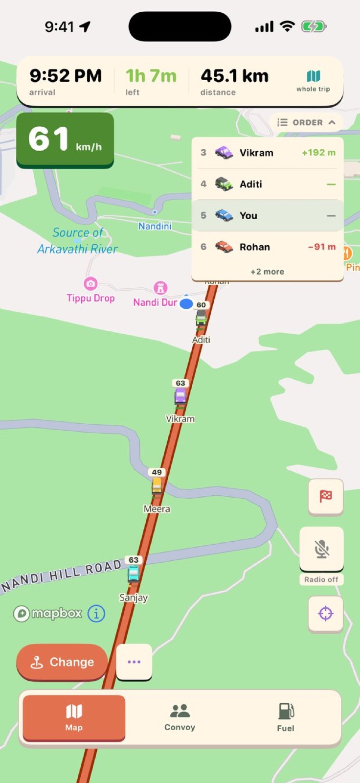 The convoy map: every car's position, speed and heading, live for everyone at once.
The running order stays current as the drive goes on. If a car overtakes, the order updates. If the gap between the second and third car stretches past a comfortable distance, every driver sees it without anyone sending a message. The convoy view gives the whole group a shared picture of what's happening, rather than a collection of individual location pins each driver is checking on their own schedule.
Shared destination and ETAs
The other half of convoy coordination is the destination. In a standard setup, the organiser drops a pin in the group chat and everyone sets it in their own navigation app. If the plan changes mid-drive — there's a better lunch spot further along, or traffic makes the original stopping point impractical — it goes back into the chat and drivers update at the next junction.
In DriveStream, a shared destination reaches every phone in the convoy at once. Turn-by-turn navigation runs from that destination for every driver. If a stop gets added or moved mid-drive, everyone gets the update at the same time. Traffic-aware ETAs for each car update separately, because the car at the back of a strung-out convoy has further to go than the one at the front, and the app knows the difference.
Multi-stop itineraries work the same way. A route with a petrol stop, a viewpoint, a lunch spot and an end destination can be built before anyone leaves, and every car works through the same list together. Nobody needs to track a screenshot of the plan.
Fuel
One of the routine ways a convoy loses cohesion is a car that is low on fuel and doesn't say anything until it's pulling off the road. With three or four vehicles moving together, that is a stop none of them planned for.
DriveStream shows every driver's tank level and remaining range on the shared screen. The whole group can see when one car's range is tightening and plan the fuel stop together before it becomes urgent.
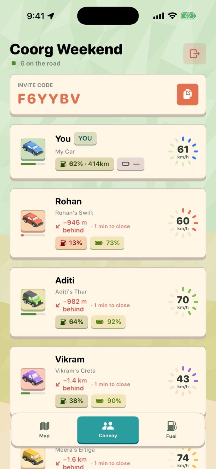 The convoy list: gap to the car ahead, speed, fuel level and battery for every car in the group.
CarPlay
The convoy map and turn-by-turn navigation work through CarPlay. The dashboard screen shows every car's position and the shared route alongside standard navigation directions. The phone stays in a pocket.
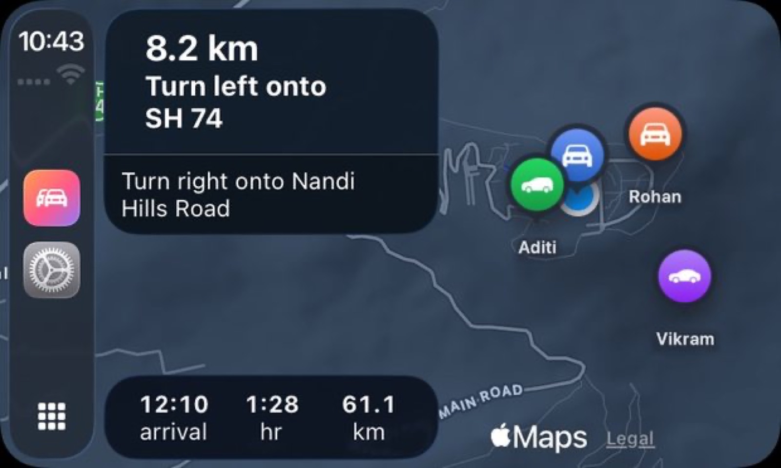 CarPlay: the convoy map and navigation on the dashboard, without touching a phone.
Privacy
Using a location-sharing feature from a large navigation app means your position is going somewhere beyond the other cars in your convoy. DriveStream shares location only within your trip. When you leave a trip, sharing stops. The app has no advertising SDKs, no analytics trackers, and no data sold to third parties.
The short answer
Google Maps is the right tool for getting one car from one place to another. For a convoy where the problem is keeping multiple cars together — sharing where everyone is, what their fuel situation looks like, and what the plan is for the next stop — it is not what the app was built for.
DriveStream is on the App Store for iPhone running iOS 26 or later. drivestream.app has the details.